Fry & Jefferson 1755 Map
A Map of the Most Inhabited Part of Virginia Containing the Whole Province of Maryland with Part of
Pensilvania, New Jersey and North Carolina. London, [1755]
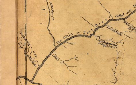
Buffalo Creek is a stream - unidentified by me at this moment - north of Wheeling Creek. The split creek
between Buffalo Creek and Letort's Creek is in the correct position to be Wheeling Creek. At this time, at
least on this map, it has no name. The broad tributary just at the bottom of this excerpt is labelled "Great
Konhaway" on the full map. This is the Kanawha River.
Small version of entire Map of Virginia by Fry and Jefferson. The Wheeling Creek area is at top left.
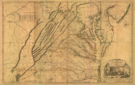
See Library of Congress for full map.