Difference between revisions of "Belmont Covered Bridge"
(Created page with "<div id="content_view" class="wiki" style="display: block">CoveredBridge_isle_ohio-1870.gif<br /> ''from the 1870 map of Wheeling ([...") |
|||
| Line 1: | Line 1: | ||
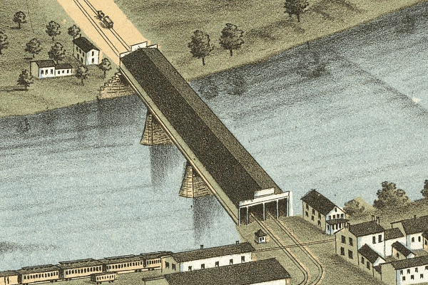
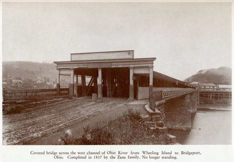
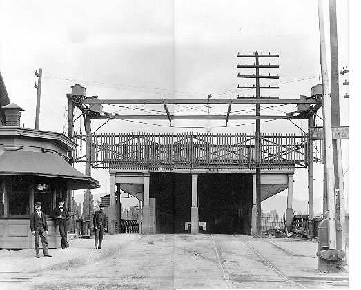
| − | <div id="content_view" class="wiki" style="display: block">[[Image:CoveredBridge_isle_ohio-1870.gif|CoveredBridge_isle_ohio-1870.gif]]<br /> ''from the 1870 map of Wheeling ([ | + | <div id="content_view" class="wiki" style="display: block">[[Image:CoveredBridge_isle_ohio-1870.gif|CoveredBridge_isle_ohio-1870.gif]]<br /> ''from the 1870 map of Wheeling ([[References|Chicago Map Co.]])''<br /> Started in 1833 by Noah Zane, completed in 1836 (or 1837), connecting Wheeling Island to Bridgeport, Ohio; replaced in 1893 by current [[Bridgeport%20Iron%20Bridge|Iron Bridge]].<br /> <br /> [[Image:BelmontCoveredBridge.jpg|BelmontCoveredBridge.jpg]]<br /> ''Photo from [[References|Milton, 1943]].''<br /> <br /> [[Image:CoveredBridge-BridgeportSide.jpg|CoveredBridge-BridgeportSide.jpg]]<br /> Covered Bridge seen from Bridgeport side. <br /> ''From [http://wheeling.weirton.lib.wv.us/history/photos/brown/BROWN.HTM Brown Collection of Photos at Ohio Public Library.]''<br /> <br /> Bridges in the 1800s were often covered to protect the wood that was used for all but stone columns that rose from the river floor. <br /> <br /> Sources:<br /> [http://wheeling.weirton.lib.wv.us/history/landmark/bridges/index.htm Wheeling Bridges]<br /> <br /> |
---- | ---- | ||
| − | Back to [ | + | Back to [[Bridges|Bridges]]</div> |
Latest revision as of 19:53, 23 April 2018

from the 1870 map of Wheeling (Chicago Map Co.)
Started in 1833 by Noah Zane, completed in 1836 (or 1837), connecting Wheeling Island to Bridgeport, Ohio; replaced in 1893 by current Iron Bridge.

Photo from Milton, 1943.

Covered Bridge seen from Bridgeport side.
From Brown Collection of Photos at Ohio Public Library.
Bridges in the 1800s were often covered to protect the wood that was used for all but stone columns that rose from the river floor.
Sources:
Wheeling Bridges
Back to Bridges