Difference between revisions of "Maps"
(Created page with "<div id="content_view" class="wiki" style="display: block"> ==Maps and Panoramas== The history of every place can be traced by changes in maps over the decades and centurie...") |
|||
| Line 2: | Line 2: | ||
==Maps and Panoramas== | ==Maps and Panoramas== | ||
The history of every place can be traced by changes in maps over the decades and centuries.<br /> <br /> | The history of every place can be traced by changes in maps over the decades and centuries.<br /> <br /> | ||
| − | * 1755 [[Image:Fry%26Jefferson1755map.jpg|Fry&Jefferson1755map.jpg]][ | + | * 1755 [[Image:Fry%26Jefferson1755map.jpg|Fry&Jefferson1755map.jpg]][[Fry%20%26%20Jefferson%201755%20Map|Map by Joshua Fry and Peter Jefferson]] (Thomas' father) of Virginia ([http://memory.loc.gov/cgi-bin/map_item.pl?style=lewisandclark2&data=/gmd388/g3880/g3880/ct000370.sid&title=A+Map+of+the+Most+Inhabited+Part+of+Virginia+Containing+the+Whole+Province+of+Maryland+with+Part+of+Pensilvania&itemLink=http://www.loc.gov/exhibits/lewisandclark/lewis-before.html%238 Library of Congress]). Excerpt of Wheeling Creek area (?) |
| − | * 1755 [[Image:WheelingArea-JohnMitchell1755.jpg|WheelingArea-JohnMitchell1755.jpg]] Map of [ | + | * 1755 [[Image:WheelingArea-JohnMitchell1755.jpg|WheelingArea-JohnMitchell1755.jpg]] Map of [[British%20and%20French%20dominions%20in%20North%20America%2C%201755|British and French dominions in North America, 1755]] ([http://memory.loc.gov/cgi-bin/map_item.pl Library of Congress] |
* 1796 Map of Victor Collot showing buildings and fort at Wheeling. | * 1796 Map of Victor Collot showing buildings and fort at Wheeling. | ||
| − | * 1802 [ | + | * 1802 [[Aaron%20Arrowsmith%2C%201802|Aaron Arrowsmith's]] map of North America |
| − | * 1817 [ | + | * 1817 [[The%20Navigator%201817%20Map|The Navigator 1817 Map]] map of Ohio River and description of Wheeling |
| − | * ~1830s [[Image:Wheeling-pre-1849.JPG|Wheeling-pre-1849.JPG]] Famous [ | + | * ~1830s [[Image:Wheeling-pre-1849.JPG|Wheeling-pre-1849.JPG]] Famous [[Early%20Wheeling|drawing]] from before the Suspension Bridge (pre-1849) |
| − | * ~ 1849 [[Image:Wheeling~1849.jpg|Wheeling~1849.jpg]][ | + | * ~ 1849 [[Image:Wheeling~1849.jpg|Wheeling~1849.jpg]][[Early%20Wheeling|engraving]] from Wheeling Hill south |
| − | * 1853 [[Image:1853mapsmaller.jpg|1853mapsmaller.jpg]][ | + | * 1853 [[Image:1853mapsmaller.jpg|1853mapsmaller.jpg]][[City%20of%20Wheeling%20-%201853|City of Wheeling - 1853]] by Manfred & Simpson. |
| − | * 1854 [[Image:1854-fromCahplineStHill-EdwardSasche-OCPL.jpg|1854-fromCahplineStHill-EdwardSasche-OCPL.jpg]][ | + | * 1854 [[Image:1854-fromCahplineStHill-EdwardSasche-OCPL.jpg|1854-fromCahplineStHill-EdwardSasche-OCPL.jpg]][[Drawing%20of%20Wheeling%20from%20Chapline%20Hill|Drawing of Wheeling from Chapline Hill]] by Edward Sasche |
* 1857 [[Image:Wheeling-Harpers1857small.jpg|Wheeling-Harpers1857small.jpg]][http://historic-wheeling.wikispaces.com/Early+Wheeling Wheeling] from April 1857 ''Harpers Monthly''. | * 1857 [[Image:Wheeling-Harpers1857small.jpg|Wheeling-Harpers1857small.jpg]][http://historic-wheeling.wikispaces.com/Early+Wheeling Wheeling] from April 1857 ''Harpers Monthly''. | ||
| − | * 1870 [[Image:1870map.gif|1870map.gif]][ | + | * 1870 [[Image:1870map.gif|1870map.gif]][[Wheeling%2C%201870%20Map|Wheeling, 1870 Map]] Classic birds-eye View! |
| − | * 2008 [[Image:Whl-river-pan-30%25.jpg|Whl-river-pan-30%.jpg]][ | + | * 2008 [[Image:Whl-river-pan-30%25.jpg|Whl-river-pan-30%.jpg]][[Ohio%20River%20View|Ohio River View]] Photo panorama from March 2008 |
<br /> | <br /> | ||
---- | ---- | ||
| − | + | </div> | |
Latest revision as of 18:56, 23 April 2018
Maps and Panoramas
The history of every place can be traced by changes in maps over the decades and centuries.
- 1755
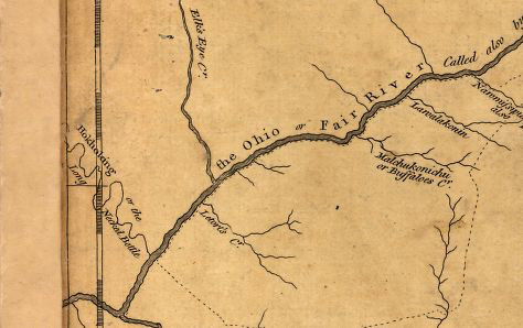 Map by Joshua Fry and Peter Jefferson (Thomas' father) of Virginia (Library of Congress). Excerpt of Wheeling Creek area (?)
 - 1755
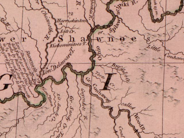 Map of British and French dominions in North America, 1755 (Library of Congress
 - 1796 Map of Victor Collot showing buildings and fort at Wheeling.
- 1802 Aaron Arrowsmith's map of North America
- 1817 The Navigator 1817 Map map of Ohio River and description of Wheeling
- ~1830s
Famous drawing from before the Suspension Bridge (pre-1849)
- ~ 1849
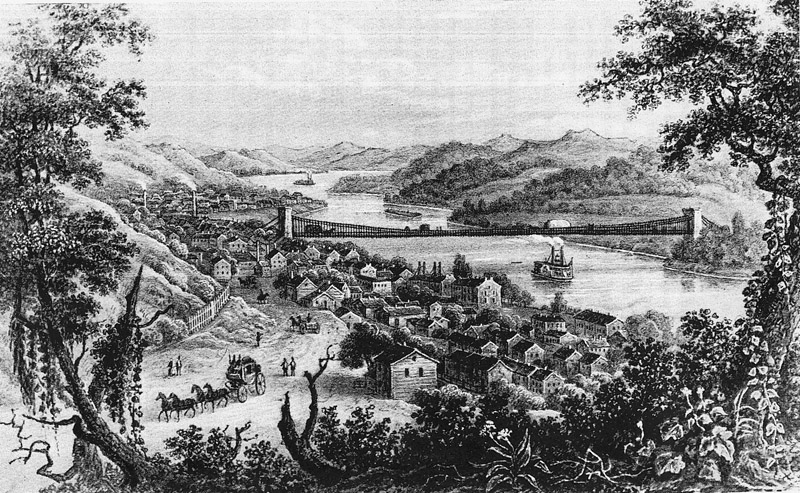 engraving from Wheeling Hill south
 - 1853
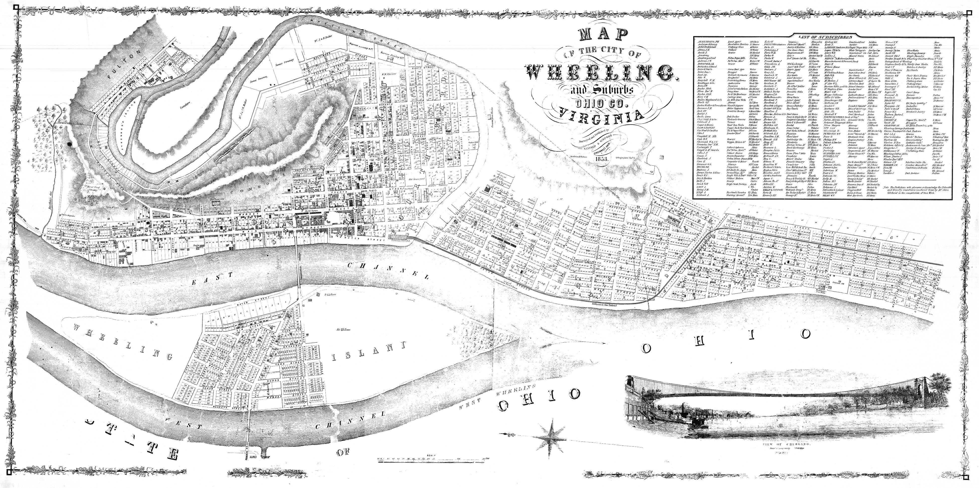 City of Wheeling - 1853 by Manfred & Simpson.
 - 1854
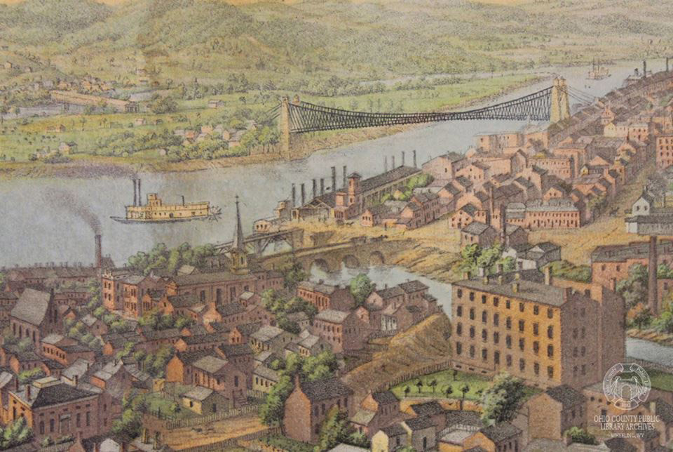 Drawing of Wheeling from Chapline Hill by Edward Sasche
 - 1857
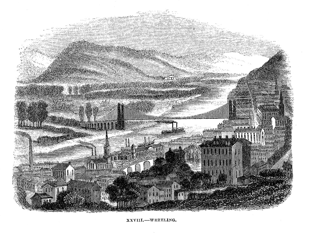 Wheeling from April 1857 Harpers Monthly.
 - 1870
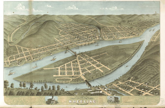 Wheeling, 1870 Map Classic birds-eye View!
 - 2008
 Ohio River View Photo panorama from March 2008